We conduct analyses to measure, document, and if appropriate, minimize or determine mitigation measures for impacts to the natural and human environment that could result from the proposed projects. Areas of analysis include biological resources, human environment and the physical environment.
Dredge material is placed in a variety of upland and aquatic habitats (including estuarine and tidal marsh) where erosion has occurred due to acute disturbance (e.g. storms) or chronic impacts (e.g. currents). The Port of Corpus Christi Authority works closely with the Coastal Bend Bays & Estuaries Program on bird studies and programs, including conducting bird surveys, predator management, and providing funding for creating, enhancing or restoring habitat and nesting areas.
Reusing Dredged Material
Dredged material, or material that is removed from the bay bottom to create additional depth can serve a wide variety of useful purposes.
- Habitat creation and restoration: Restored wildlife habitats, wetlands, rookery islands and oyster reefs
- Beach nourishment: Restored beaches and dunes subject to erosion
- Shoreline stabilization: Living shorelines, fill for breakwaters, geotubes and wave breaks
Dredged Material Management
Dredge material free of contaminants can be reused to create and restore estuarine, aquatic and marsh habitats, provide beach and dune nourishment, expand and repair existing placement areas, restore eroded shorelines or provide protection to seagrass areas. Feeder berms in the Gulf can nourish beach shorelines through the natural sediment transport process.
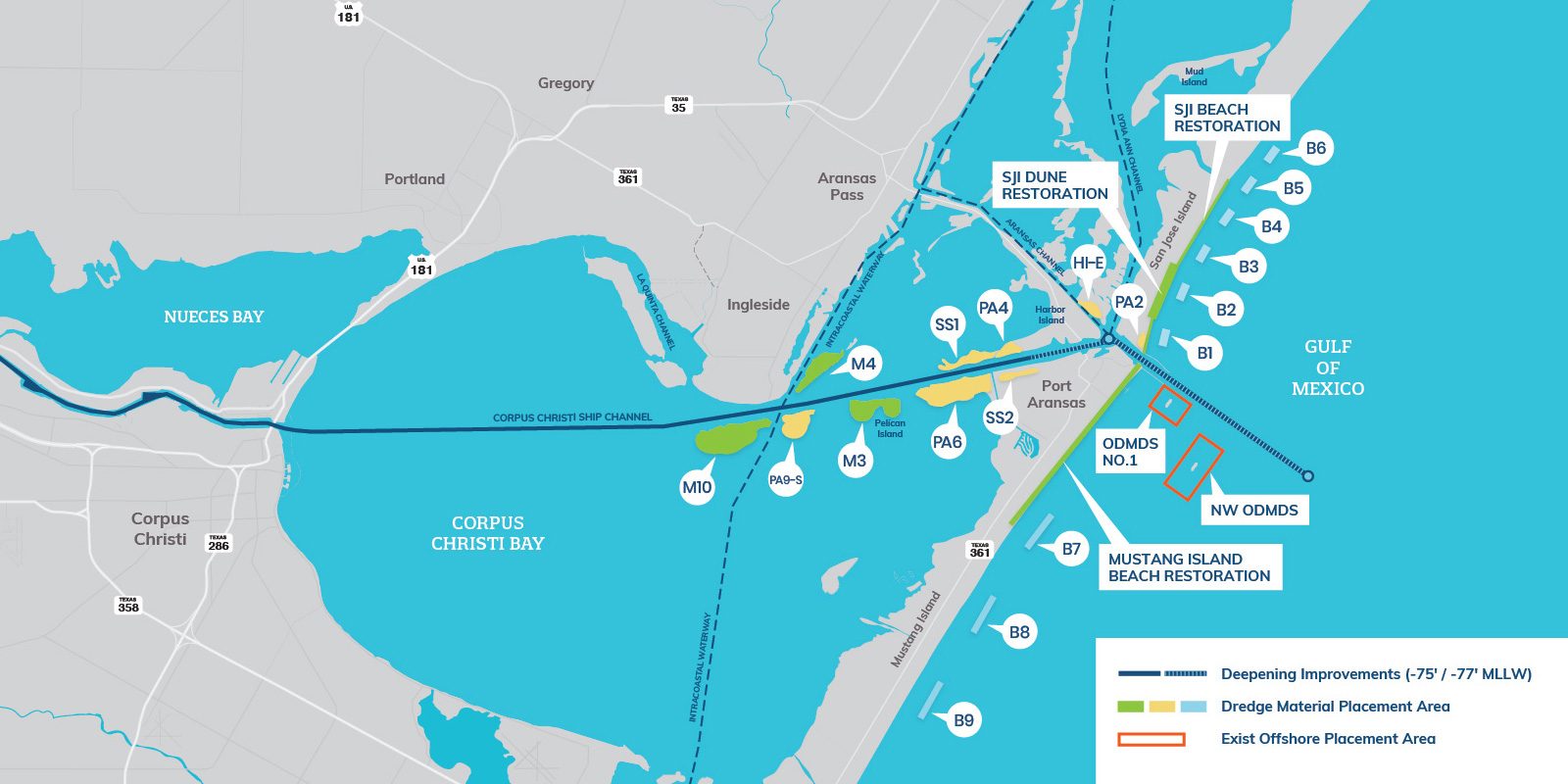
This map includes beneficial use projects that have been identified by stakeholders.
Restoration Projects
Stakeholders continually identify placement opportunities, for which the Port advances planning, design, and permitting to create opportunities for placement that align with dredging operations in the area.
Eleven (11) beneficial use features have been identified to achieve a variety of shoreline restoration, land loss restorations, marsh cell expansion and Gulf-side shoreline initiatives. Wetland delineation surveys and field work were performed to determine acreage of existing wetland ecosystems and natural seagrass habitats within the proposed placement sites.
